
One neighborhood, a full experience
Asakusa brings temple visits, small shops and riverside views within one outing. For a first visit, stay around Kaminarimon and Senso-ji, enjoy lunch nearby, then choose a river walk or a terrace view. You do not need to add a distant district to make the day worthwhile.
JapaLens editorial plan · Reviewed 21 Oct 2026. Visit durations and budget allocations below are planning suggestions, not operator guarantees.
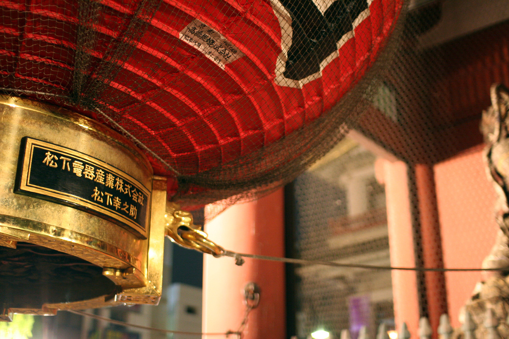
© Toshihiro Oimatsu / Wikimedia Commons · CC BY 2.0 · Cropped for display
Four stops to build your visit around
Kaminarimon & Nakamise
Start at the red lanternKaminarimon is the outer gate of Senso-ji. Beyond it, Nakamise leads toward the temple. Look at the lantern and the small shopfronts, then keep moving with the flow of visitors. Each shop sets its own opening hours.
Senso-ji
Make time for the visit itselfPass through Hozomon toward the main hall, then look around the precincts. Senso-ji is an active Buddhist temple: follow posted instructions and avoid blocking worshippers. Check the temple website for main-hall opening hours; these differ from simply walking through the area.
Sumida riverside
A quieter change of sceneAfter the temple, head toward the river for a different view of the neighborhood. Sumida Park offers riverside scenery and views toward Tokyo Skytree. Keep the walk short in heat, rain or strong wind; a café break can replace this part of the plan.
Asakusa Culture Tourist Information Center
Get your bearings above the streetsAcross from Kaminarimon, this Taito City facility provides visitor information in several languages. Its eighth-floor observation terrace is free and overlooks Asakusa and Tokyo Skytree. The information counter and terrace have different operating hours.
A half-day route, with room to pause
Allow around 3–4 hours including lunch. This is an editorial walking plan; queues, shopping and weather will change the pace. Start after checking opening hours for the day.
- 01
Asakusa Station → Kaminarimon
Check your railway operator and exit, then walk to the gate. Start with a photo without blocking the entrance.
- 02
Nakamise → Senso-ji
Browse on the way to the main hall. Allow 60–90 minutes for the shopping street and temple together.
- 03
Lunch and a seated break
Choose a restaurant before you get too tired. Keep about an hour for lunch rather than relying on snacks alone.
- 04
Sumida riverside → terrace
Enjoy a short riverside walk, then finish at the tourist information center. Skip one stop if walking feels too much.
Keep Kaminarimon, Nakamise and Senso-ji, then take a short seated break. Save the river and terrace for a longer visit.
Get your bearings
Kaminarimon and the tourist information center are south of Senso-ji; the Sumida River is to the east. Use the map to check your actual walking route.
Plan lunch as part of the walk
Choose a meal, then add a small treat
Soba, tempura and Japanese meals can anchor your lunch stop. If you want sweets or snacks, leave room after lunch. Follow each shop’s guidance on where to eat and dispose of packaging.
For allergies or dietary restrictions, check ingredients and shared preparation directly. A cuisine label or an English menu is not a guarantee of suitability.
A budget you can set
- Lunch
- ¥1,500–3,000
- Snack / café
- ¥500–1,000
- Personal food budget
- ¥2,000–4,000
Per person, suggested allocation only. Not a quote or a restaurant price range. Transport, shopping and paid activities are extra; check actual menu prices before ordering.
A listed restaurant near Azumabashi
Gonpachi Asakusa Azumabashi
Soba, skewers and tempura near Azumabashi Bridge.
View details & booking →Our branch page brings together the published address, access, hours and official reservation route. Check the menu and booking conditions there before deciding.
Listed option, not a ranking or an on-site review. Restaurant photographs are not yet available.
Getting to the right Asakusa Station
Tokyo Metro Ginza Line, Toei Asakusa Line and Tobu serve the riverside station area. Tsukuba Express Asakusa Station is in a different location. Share the railway operator and exit with your travel companions.
- For the Ginza Line, use the official Asakusa Station page to find the exit toward Kaminarimon and Senso-ji.
- For luggage, a stroller or step-free travel, check the operator’s current elevator information rather than choosing only the nearest staircase.
- Save the route back to your accommodation before you start walking. Fares and travel times depend on your starting point.
Small choices that make the day easier
In rain or intense heat
Shorten the riverside section and spend more time over lunch or at the tourist information center. Shops have different hours, so do not rely on an early-morning shopping plan.
Photos and local etiquette
Keep temple entrances and pavements clear, ask before photographing shop interiors or people, and follow signs. Carry small purchases securely and take breaks before fatigue builds up.
Is half a day enough?
Yes, if you focus on the temple area, lunch and one extra stop. Add more time for long shopping breaks or a separate activity.
Do I need to book everything?
This walking plan is not a bookable package. Check each restaurant or activity separately for reservations and cancellation rules.